mregions tutorial
for v0.1.6
mregions is useful to a wide diversity of R users because you get access to all of the
data MarineRegions has, which can help in a variety of use cases:
- Visualize marine regions alone
- Visualize marine regions with associated data paired with analysis
- Use marine region geospatial boundaries to query data providers (e.g., OBIS (http://www.iobis.org))
- Geocode - get geolocation data from place names
- Reverse Geocode - get place names from geolocation data
Installation
Stable version from CRAN
install.packages("mregions")
Development version from GitHub
if (!require("devtools")) install.packages("devtools")
devtools::install_github("ropenscilabs/mregions")
library("mregions")
GeoJSON
Get region
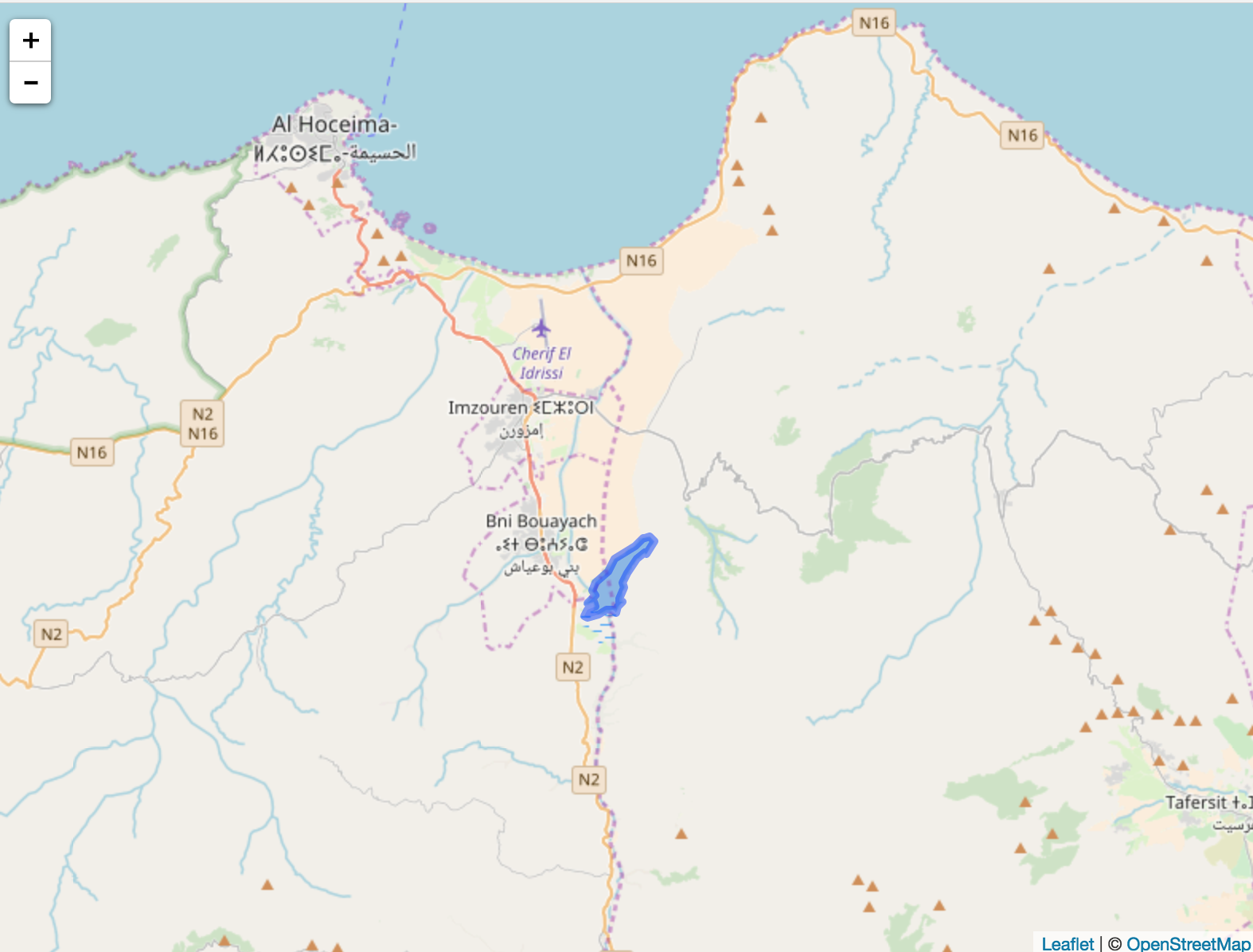
res1 <- mr_geojson(key = "Morocco:dam")
Get leaflet library
install.packages("leaflet")
Plot data
library('leaflet')
leaflet() %>%
  addProviderTiles(provider = 'OpenStreetMap') %>%
  addGeoJSON(geojson = res1$features) %>%
  setView(-3.9, 35, zoom = 10)
Shape
Get region
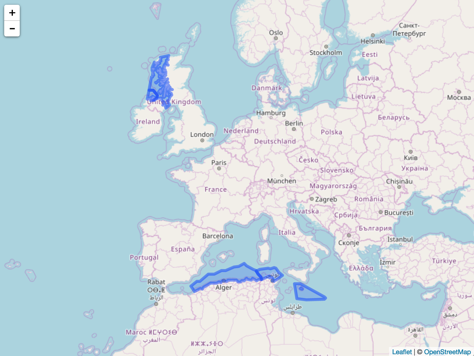
res2 <- mr_shp(key = "MarineRegions:eez_iho_union_v2", maxFeatures = 5)
Get helper library
install.packages("leaflet")
Plot data
library('leaflet')
leaflet() %>%
  addProviderTiles(provider = 'OpenStreetMap') %>%
  addPolygons(data = res2)
Convert to WKT
From geojson
res3 <- mr_geojson(key = "Morocco:dam")
mr_as_wkt(res3, fmt = 5)

#> [1] "MULTIPOLYGON (((41.573732 -1.659444, 45.891882 ... cutoff
From shp object (SpatialPolygonsDataFrame) or file, both work
mr_as_wkt(mr_shp(key = "MarineRegions:eez_iho_union_v2"))

#> [1] "GEOMETRYCOLLECTION (POLYGON ((-7.25 ... cutoff
Get OBIS EEZ ID
mr_obis_eez_id("bulgarian exclusive economic zone")
#> [1] 71
Citing
Scott Chamberlain (2017). mregions: Marine Regions Data from ‘Marineregions.org’. R package version 0.1.46. https://CRAN.R-project.org/package=mregions
License and bugs
- License: MIT
- Report bugs at our GitHub repo for mregions
